Archive for March, 2014
A Little Diamond of a Place
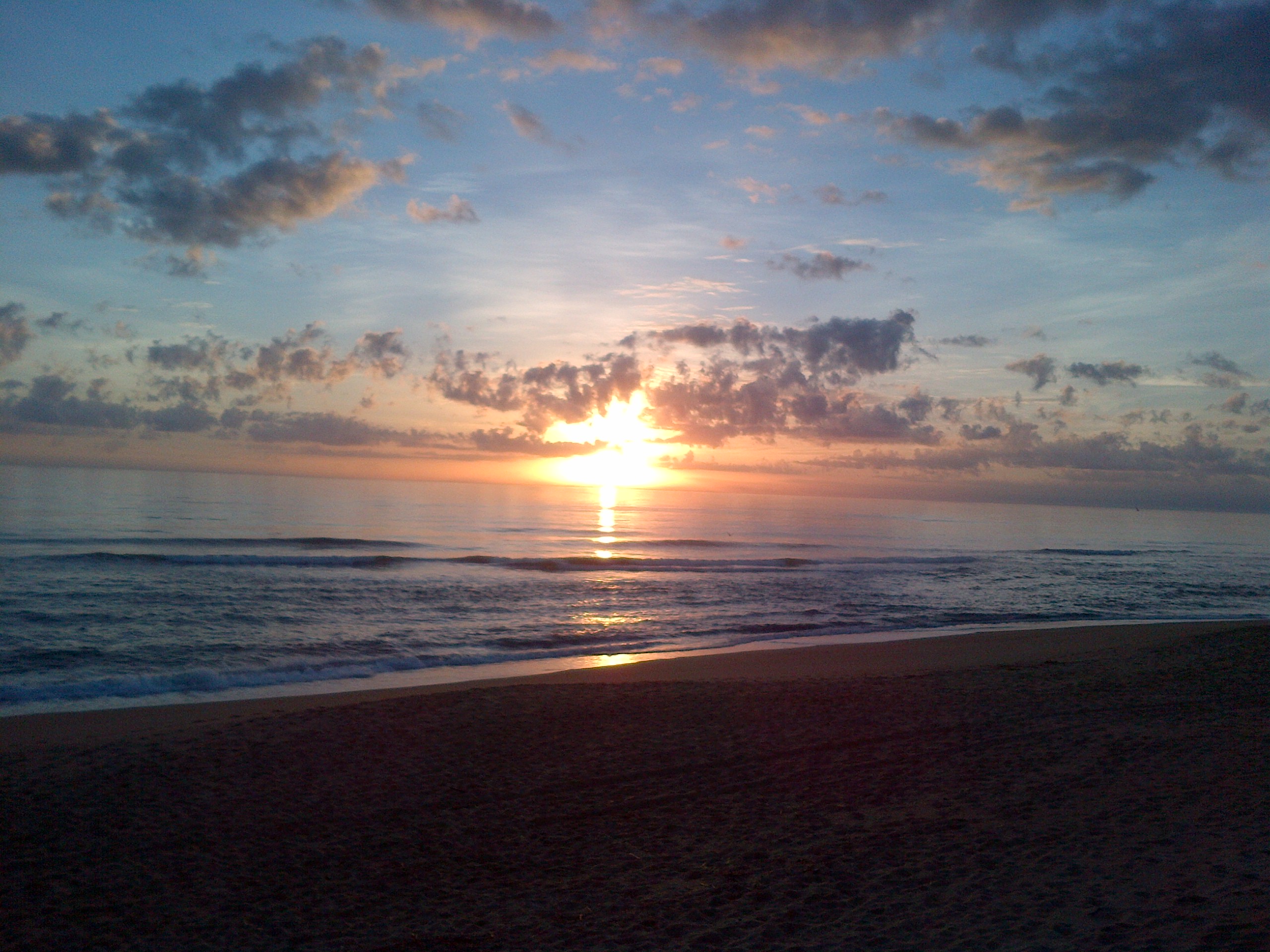
 Following a recommendation for a good fishing spot is plain vanilla for most but locating a new spot that turns out to be perfect by accident is a diamond. This is what happened to me during a recent trip in east central Florida.
We had a free day between two MLB Spring Training games and decided to do some sightseeing in Brevard County. We traveled east from Route 95 over the Merritt Island Causeway when we got stopped at defective traffic signal. Looking for a place to turn around, we ended up in a parking lot of a restaurant and an old bait shop. The two buildings were at the base of the Causeway Bridge and just east of Indian River.
The tackle shop was located down a long driveway between the causeway and a small cove off the Indian River. The drive was well worn and past its usefulness but I was still able to find a safe parking spot. The shop was an old building converted into a bar, pool hall and bait shop.
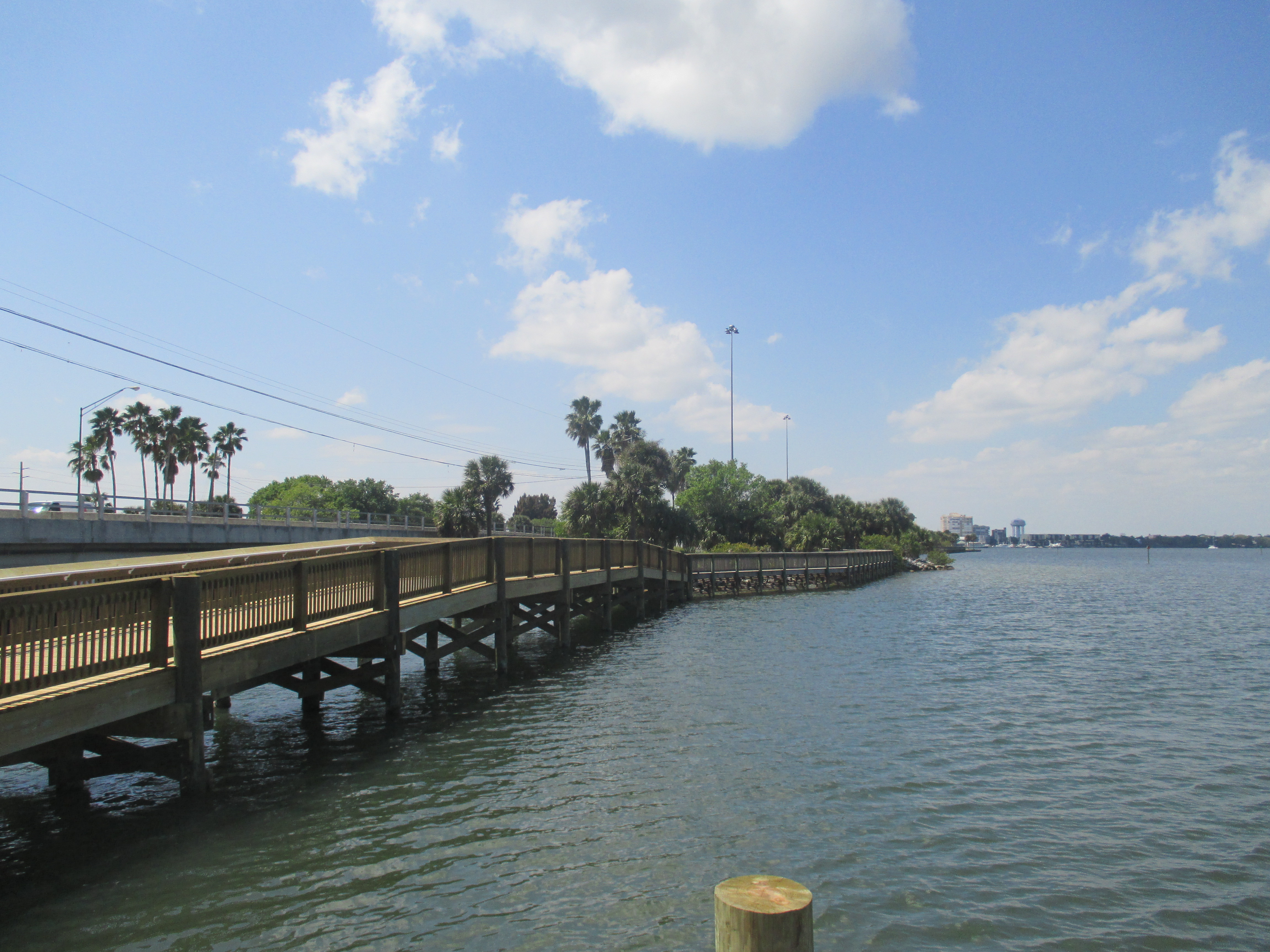
I found an old dock adjacent to a cove with flat water and a new dock and walkway that extended out along the north base of the causeway bridge.
Cove had flat water close in and a fast current within a short cast of the old dock. The Indian River which fed the cove is one part of a large estuary along the east coast of Florida. The system consists of the Mosquito Lagoon, Banana River and the Indian River. So there was a good chance that fish would be there.
I tried several methods finally settling on live shrimp suspended under a weighted bullet float. My 7-1/2 foot light Falcon rod and Daiwa reel were my only other tools.
It seemed once I hit that change in water speed and bottom configuration, the fishing was tremendous. Every other cast was productive. Small throw back speckled trout was the main stay but blow toads kept me busy baiting back up.
Many times we over look an out-of-the-way places because they either look strange from the road or difficult to access. Keep an eye out for these unique spots. These just might be your next diamond.
Until next time – Tightlines – Capt. Tony
Lessons Are Not All the Same
 There once was an experienced angler who learned his trade hanging out on the docks and tackle shops. He was an educator by trade but longed for the sea life. As time passed on, he become a notoriety and a sought after guide and speaker at many of the local functions.
The once was a young lad who longed to learn the seas. He heard of this experienced angler who everyone raved about – this was the angler who could teach him the seas.
One day while visiting the docks the young lad ran into the old angler. He asked the angler for assistance to learn his trade. As a great educator, the old salt jumped at the chance to share his knowledge.
The young lad then asked when can we start? The answer was today but I want to walk one of the local piers first.
The angler walked out on the pier and immediately saw an old lady having trouble with her reel so he fixed it. As the walk continued, another had a tangled line and another trouble landing a fish and then another confused on the type of lure and bait. At each stop the angler helped the stranger to get it right.
All along the young lad became frustrated at the angler then asked “when are you going to start the lesson”?
The angler said to the young lad – “my poor lad, you have been in class for hours”. Fishing is more than just catching. It’s sharing your passion with others so they too may look and enjoy life differently.
Sometime the lessons we learn are not packed as we thought. Take someone fishing and teach them a lesson of life. Or just maybe the expertise you carry is just what others may need. Don’t pass up an opportunity to make someone smile!!
Until next time – Tightlines –Capt. Tony
Something Old But Maybe New
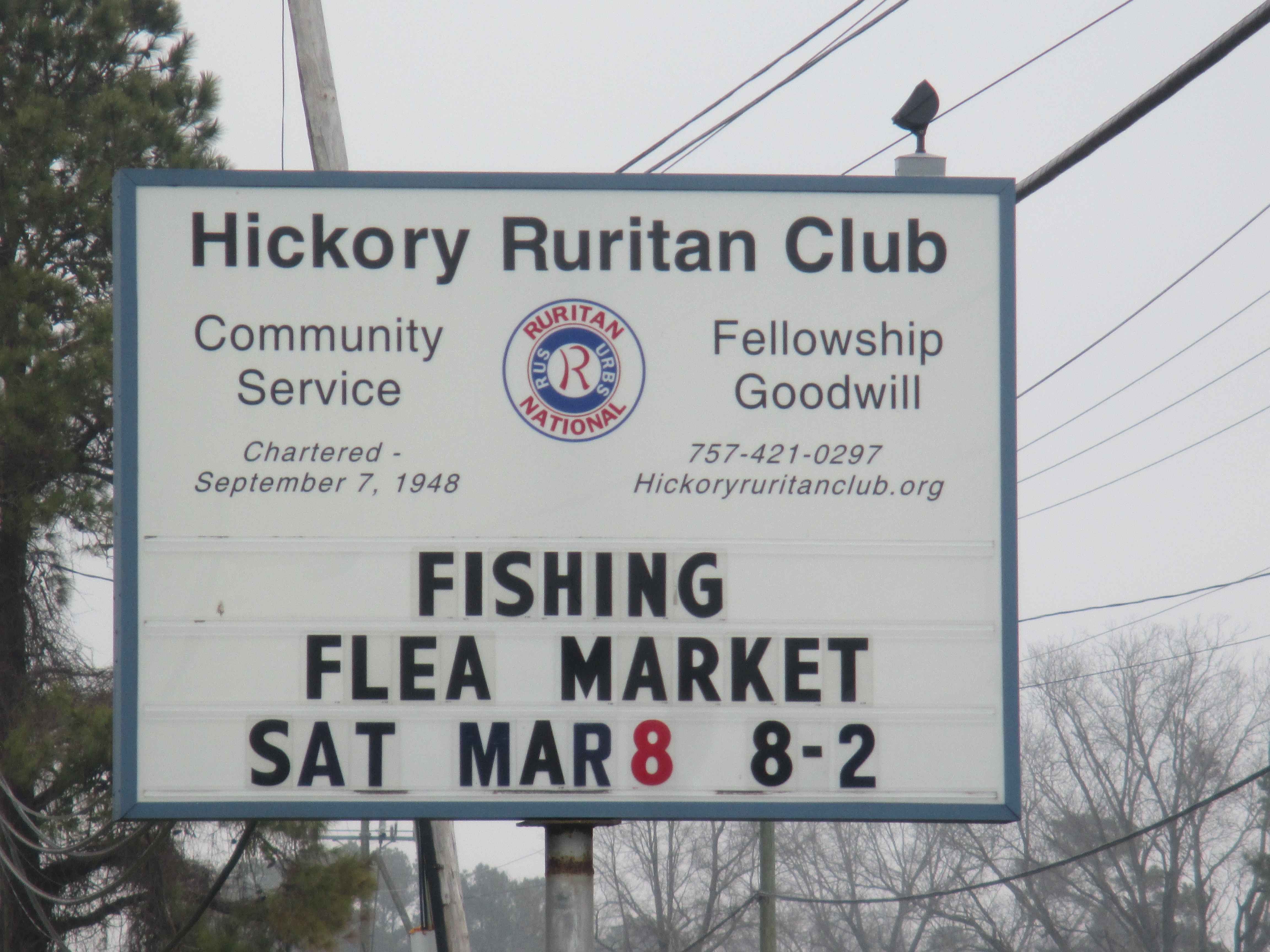
Each year the Great Bridge Fisherman’s Association holds their annual “Fishing Fleas Market” at the Hickory Ruritan Club on Old Battlefield Blvd in Chesapeake Virginia. And this year it is on Saturday, 8 March 2014.
This is the fourth year of the flea market and I believe it gets bigger and better each year.
If you are looking for that “something special” for that angler in your family then this is the place. There are tables and tents set up on three sides of the building and dozens of tables and vendors inside. You will find dozens of antique rods and reels, lures and boxes, and just about anything nautical. Most times the equipment and gear will be well used and just looking for a new home.
Get hungry during the flea – Food and beverages for sale will be available during your shopping spree.
As for me, each year I find a ‘keepsake treasure”. It is usually something I could live without but then maybe not.
Obviously, some of the equipment for sale is items old anglers are just determined to find a new home for. So if you are good at bargaining then you came the right place.
The flea market runs from 0800 – 1400 but the best deals will be had early and late.
The weather looks perfect for this year’s flea market so there should be no excuse for at least stopping by. Parking is free but there is a slight charge for entry. Door prizes are given out periodically.
So if you have some free time this Saturday – time will not be wasted.
Until next time – Tightlines – Capt. Tony
Time is Running Out
Most of us think nothing of thirty days from now. But in a little more than that short period of time, National Oceanic and Atmospheric Administration (NOAA) will stop printing the giant paper nautical chart for good. For some mariners, this is a major change. 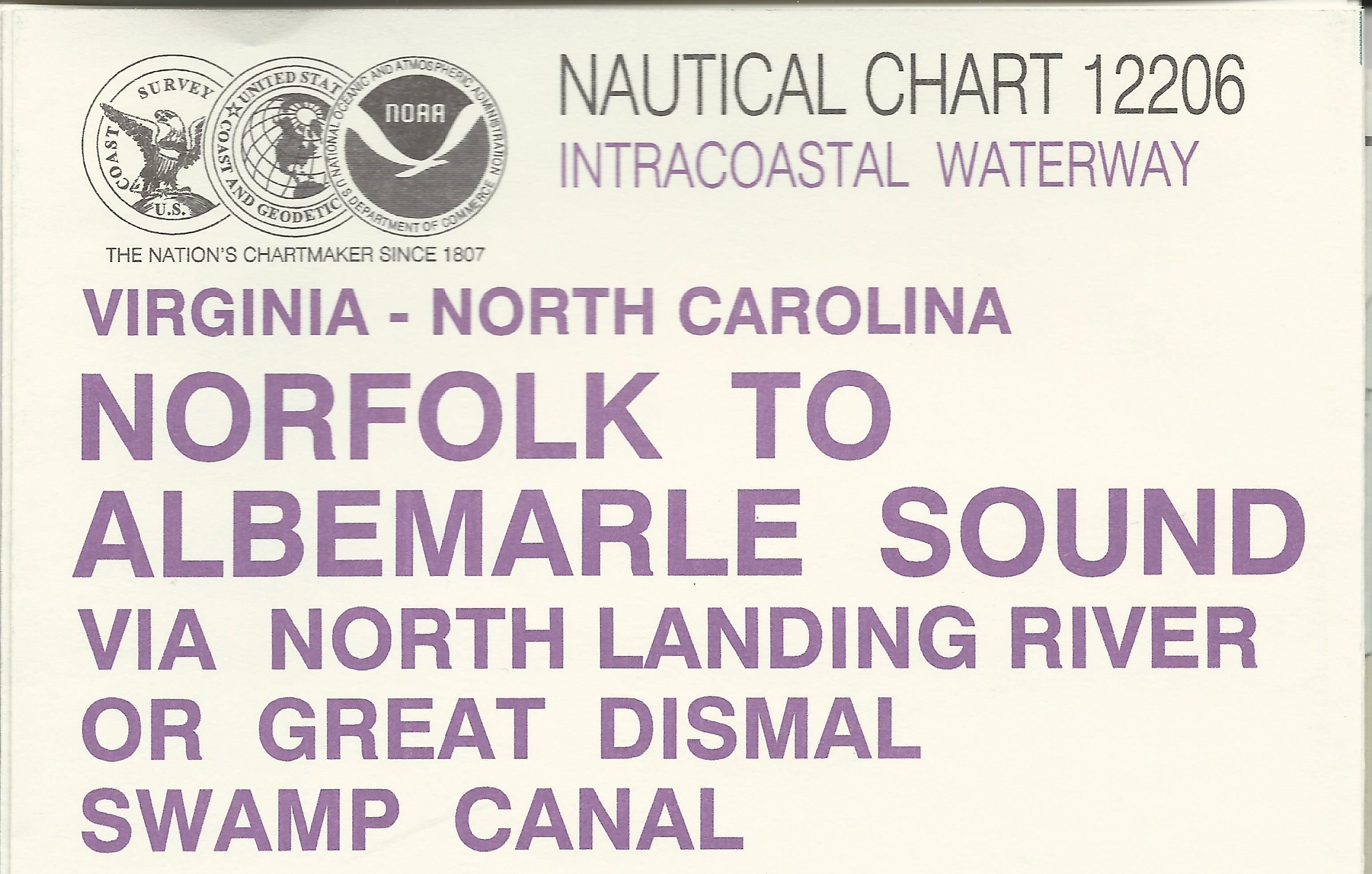
The idea of charting waters on the US coasts dates back to Thomas Jefferson when he asked the federal government to survey of the local waters for mercantile transportation. This charting process with the support of many shipping firms and the federal government then evolved into NOAA printing these heavy nautical guides in 1862.
I am sure it’s been a long time coming but I never thought it would happen in my lifetime.
Many of the current boating enthusiasts grew up with electronic maps and on-demand maps printed by private vendors. But old “salts” like me used these charts exclusively. And even though these modern charts contain the same if not more information, seasoned mariners will always fall back to the heavy paper maps.
I believe the biggest losers will be the agencies that provide U.S Coast Guard approved courses. Their compass and plotting course will undoubtedly be affected by this change.
When I took my Master’s USCG Captain’s license course, we exclusively used these heavy paper charts to plotting a course and map and compass basics. The exercises were extremely valuable to me and my current time on the water. Even today, when I plan a trip, I pull out these maps.
All is not lost though, NOAA will continue to chart for underwater depths, miscellaneous structures, topographical markings and other hazards to mariners. Gone will be the combined maps and charts.
But after mid-April, NOAA will discontinue the printing of these historical charts. Most will end up in frames hanging from dock master’s office walls.
So if you want to update your chart box with NOAA maps – better hurry up because the deadline is coming fast.
Until next time – Tightlines – Capt. Tony
